Copyright
This publication presented on this site reproduces materials and content owned or licensed by Valocity. Valocity and its licensors are the sole and exclusive owners of all rights, title and interest (including intellectual property rights) in the publication. The data contained within the publication vests in the appropriate licensor immediately upon display or publication, and all rights are reserved to the licensor.
Important Information
This Valocity Property Report is intended for general personal reference and as a guide to your own further detailed property enquiries. It contains general information only and does not take into account your personal financial needs and circumstances. This report includes information sourced from third parties. While Valocity has taken reasonable care in the preparation of this Property Review, it includes information and estimates provided by these and others and we make no representation nor give any assurance as to the accuracy, currency or relevance of the information presented. To the fullest extent permitted by law, Valocity and its data providers takes no responsibility in respect of any errors or omissions contained in or relating to this information. Users of the report must take their own independent professional advice in relation to all of the information provided in this Property Review.
Disclaimer
The Valocity data and estimates presented in this report are general in nature only and are in no way a replacement for professional advice. To the fullest extent permitted by law, Valocity excludes all loss or damage howsoever arising (including in negligence) with respect to the Valocity data and / or estimates.
State & Territory Disclaimer
The State of Victoria owns the copyright in the Property Sales Data and reproduction of that data in any way without the consent of the State of Victoria will constitute a breach of the Copyright Act 1968 (Cth). The State of Victoria does not warrant the accuracy or completeness of the Licensed Material and any person using or relying upon such information does so on the basis that the State of Victoria accepts no responsibility or liability whatsoever for any errors, faults, defects or omissions in the information supplied.
Service Agent Statement
The information is supplied by Areal Property (VIC) Pty. Ltd on behalf of Valocity Pty Limited.


 3
3
 1
1
 2
2
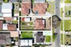
 609sqm